John and I had big plans to ascend the N. Face of Longs and then climb the Keyboard of the Winds and head back on the Loft. It became apparent by Chasm Lake we were moving too slow for all of this and due to other factors we almost had to bail at the Cables route. I was not disappointed other than the fact I hauled some unnecessary rock gear, but I had wanted to learn the Cables from the descent perspective for future adventures on Longs. Halfway down is a beta section which I think has a good primer for the N Face descent.
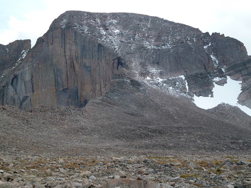
The North Face of Longs Peak. Longs is the 15th highest mountain in Colorado. It is the only 14000+ foot peak in Rocky Mountain National Park and is reputed to be the most climbed mountain in Colorado. It's challenging East Face, the "Diamond" is the wall to the left of the picture, is the biggest Alpine wall in the US except for maybe some in Alaska and its proximity to Boulder ( 1 hour ) make it a frequent target of skilled mountaineers.
Summary
Our ascent route took the Chasm Lake trail to Camel Gulley exiting the South flank of Mt. Lady Washington and on to the base of the North Face at Chasm View. We ascended the Cables Route then scrambled 3rd class to the summit. For the descent we crossed the boulder field and took the standard Keyhole trail back to the trailhead.
Route
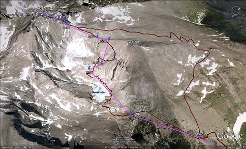
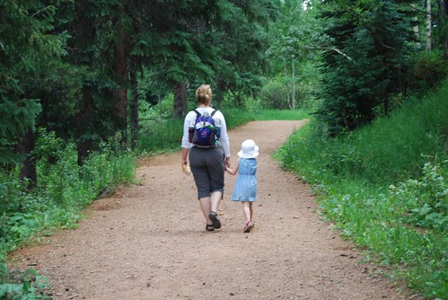
Our track is the dark red line. You can see our return trip added an entire mile to our walk back.
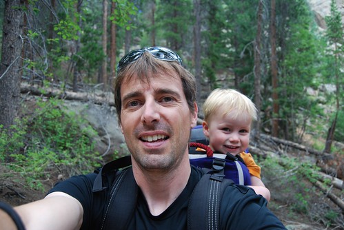
Climbers
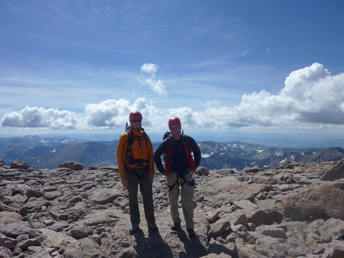
John (right) and Rick (me on the left). We tried to sleep in the back of John's Expedition, neither one of us slept well, maybe 1.5 hours for me. This was my first time on the top of Long's Peak and probably my last long climb of the year, I am just not in good enough shape for these trips. It was only my second major peak of the summer and I haven't been doing much for physical conditioning. I really felt it on this climb. John is scheduled for hip surgery and was not feeling well that day. We were both feeling pretty good about being on top in this photo though, persistence pays.
Stats
Summit 14259 Feet / 4346 Meters
Trailhead 9400 Feet / 2870 Meters
13.0 miles / 21 Kilometers
5168 Feet / 1575 Meters elevation gain
15hrs Round trip
Approach Hike
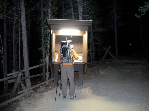
Me signing in at the trailhead at 3:30am. We were the only party to list our destination as the North Face so things were looking promising. This is the first hike or mountaineering trip of any kind I have been on with a lighted trailhead register, a sign of things to come.
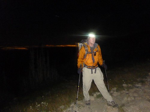
Denver lights over John's right shoulder. John and I soon became part of the train of headlamps headed up the trail at 3:30am. Because of the radical weather swings in Rocky Mountain National Park and Longs Peak's prominence which creates its own weather, it is best to be headed down by 12:00.
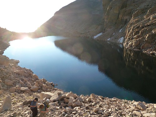
Headed up from Chasm Lake to Camel Gulley with some new found friends. While pumping water at the lake, we were approached by a lost party, they lost their friends in the dark. They were headed to the Keyhole. We invited them to tag along with us since our exit of the Camel would put them above the Keyhole trail were they could rejoin their friends.
Bottom entrance of Camel Gulley.
Talking to new people makes the time on the trail go by quick. I was pretty impressed with this group. None of them apparently had a lot of hiking experience but they held up really well and kept a good pace. I hope they were successful with the Keyhole route.
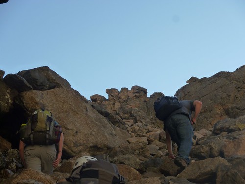
Camel Gulley with the "Camel" in the middle of the photo. This is about as steep as it gets, class 2+.
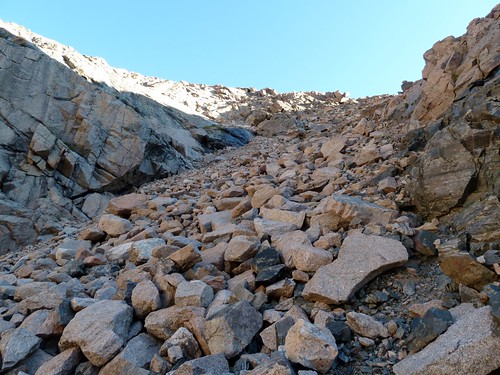
Gulley exit, from here try to go left as soon as possible and look for the grassy ledges.
We went higher before cutting left and ended up with some large boulders to hop.
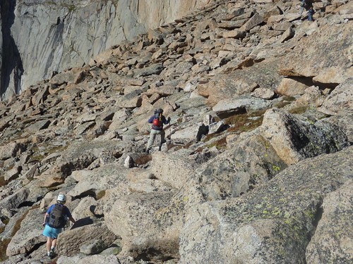
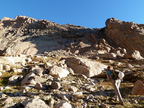
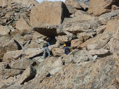
Things eventually mellowed out, the rock around the grassy areas is much easier to travel on.
North Face
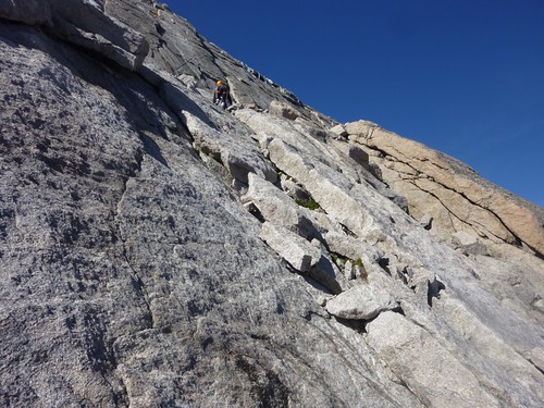
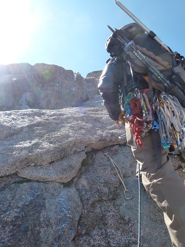
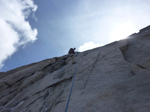
4th Class climbing to the belay ledge starting the Cables pitch.
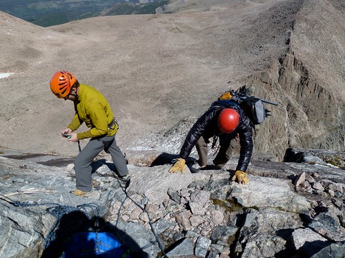
I made some friends. Once at the belay ledge we ran into 2 parties ahead of us with begining climbers. The first party turned around and left after their leader made it to the top anchors. The second party had a very strong leader and 2 new climbers. We ended up waiting at the belay ledge for 2.5 hours!
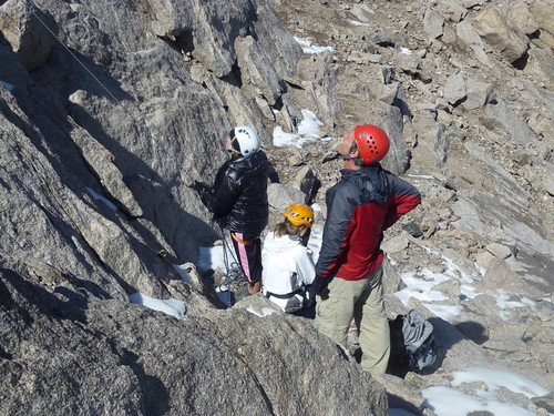
John with the "Katies" at the belay station. One of the Katies is wearing my down puffy, waiting around so long we all got pretty cold and she was shaking. The Katies did a great job eventually conquering this pitch, at least one of them had never climbed before!
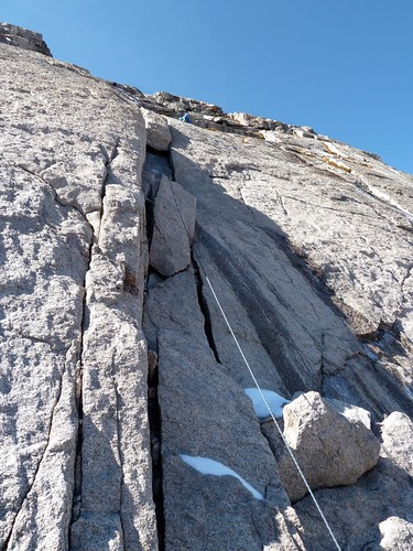
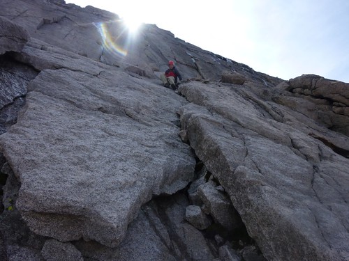
This was Ryan almost finishing the route, after moving fast to this point he was suddenly very slow. We knew something must be wrong. Those blocks in the diehedral are what you want to look for when finding this pitch.
I don't know what took Ryan so long, its only rated a 5.4. Leading the cables pitch that day required running it out on a dry slab next to the route, slopers covered with moss and final exit moves on more verglas. Nice lead Ryan!
Me cleaning the pitch. We had considered heading back and were only staying around to make sure the ladies got up the pitch. Their leader, Ryan was very gracious understanding our time crunch and offered us a toprope, we figured that would save us enough time so we took the offer and continued on.
Me above the last eyebolt. I have my down puffy back!
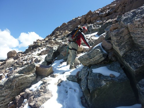
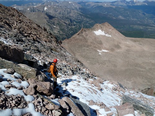
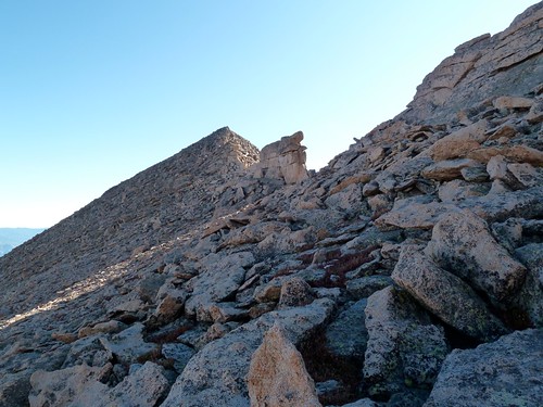
If you stay on the correct path the rest of the N. Face should stay 3rd class until the summit. The early snow this year made it interesting. We didn't bring crampons so we had to go very slowly eating up more time.
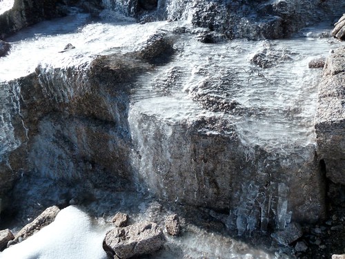
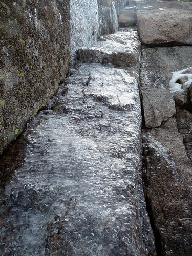
We ran into some more ice along the way.
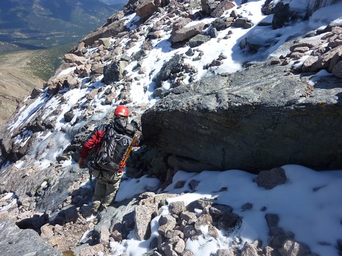
Crampons or microspikes would have been nice.
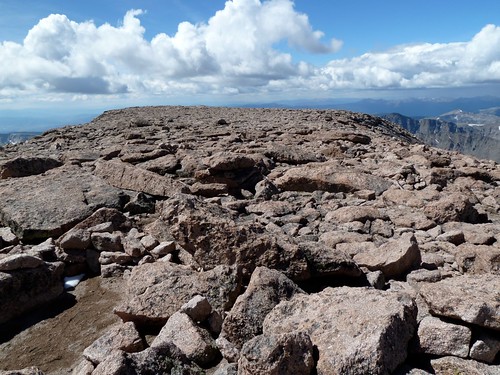
The summit of Longs Peak is a huge flat expanse.
Descent Beta
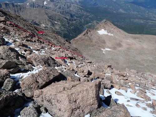
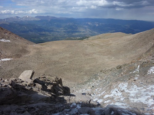
The primary things to look for are the loose boulder fields and the slabs to the North. You want to stay in the boulders to keep it 3rd class and then head North at the bottom of the red line. Keep and eye on the Chasm View overlook, that also lines up with the Cables route.
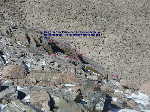
There is a rock face with green lichen that is very visible from a distance that sits directly above the top eyebolt. You can see people near it in the photo.
The green rock face was John's idea and I was skeptical we would see it at a distance. In this photo nearing the summit you can see me looking back at it. John has it centered in the photo. It shows up even better in person than it does in this photo. John was right.
John on the final Cables rappel. We moved out to the slabs to avoid the ice in the dihedral.
John and I down climbed this section below the Cables belay ledge but it can be rappelled with the last eye bolt at the bottom of the dihedral.
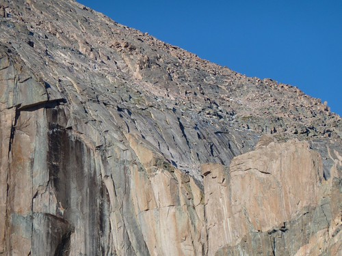
Side view of the Cables route on the lower N. Face.
This distinct rock feature is your target to regain the South Flank of Lady Washington and the Camel Gulley descending from near Chasm View.
End of Descent Beta
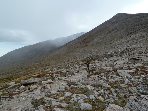
From the cables we decided to go to the Boulder Field campground and use the the Keyhole trail. That added an entire mile to our trip back and the boulder hopping to gain the trail was just as long as the boulders to regain the Camel Gulley.
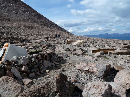
The Boulder Field campground is really amazing. The log structure in the background is to tie up livestock so don't forget your donkey or llama.
We got rained on and snowed on while descending. In a lot of ways this was a very odd trip. I have never been on a mountain as busy as Longs, it almost has a theme park quality to it but it is a very serious mountain, strange combination.
We were a little late getting back, various delays added about 3 hours or more to our trip. I was totally exhausted.